


至真至诚 ,永不止步,匠心创造,惟勤惟善
以人为本的发展模式,以服务为主的经营模式!
昕说至成(北京)公司成立于2014年,深耕光电测量行业及激光模拟训练行业多年,一直以来重视科研技术的发展和投入,具备在激光测量技术开发、芯片级嵌入式产品开发、芯片级自组网通信、快速图像识别与追踪系统、软件、光学和AI算法、高速宽带微波光子系统等领域的技术开发实力。 昕锐至成(江苏)公司坐落于江苏省淮安市高新技术产业开发区,集光电类和激光模拟训练类等产品的研发、生产销售为一体的科技型光电技术企业,公司团队拥有十年以上的光电产品设计开发和技术应用经验,是行业内成熟的激光测量技术、面向未来战场训练的技术开发及应用方案供应商。

What do we have
Industry Application


News

昕锐测距仪APP扫码下载...
测距仪、应急救援、安监、昕锐测距仪...

熟悉昕锐产品的朋友都知道昕锐自主研发的激光测距仪不仅能够测量物体之间的距离还能根据距离和角度信息测量计算出物体的高度为了满足不同行业的测高需求昕锐激光测距测高仪同时具备“两点测高”与“三点测高”两个功能模式在工作中只需要对准目标不需要考虑目标的远近和大小就能得到精度较高的测量结果今天,我们就从这两个...

福元春始风华,万象启新朝2025年元旦佳节期间,为了丰富军民文化生活,营造欢乐祥和的节日氛围,RXIRY昕锐『激光靶基础射击系统』走进淮安市军分区机关精心筹备的元旦系列庆祝活动,与淮安军分区部队领导、职工及家属共同欢度元旦佳节。2025年1月1日,淮安军分区的元旦活动现场,每一个角落都洋溢着辞旧迎新的欢乐景象。有紧...
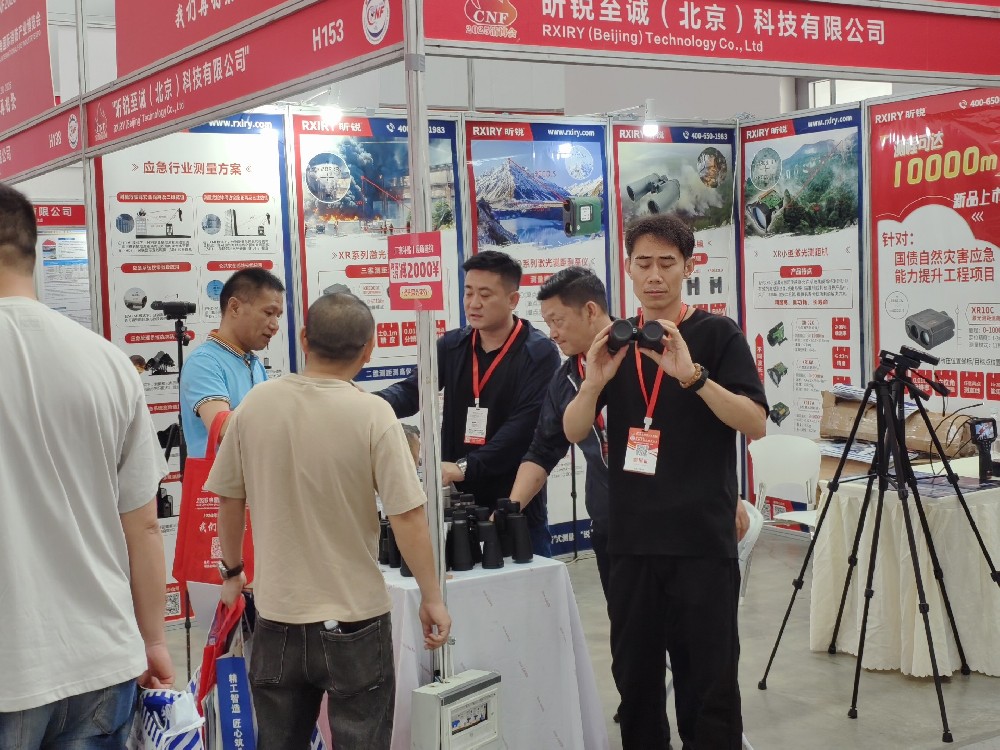
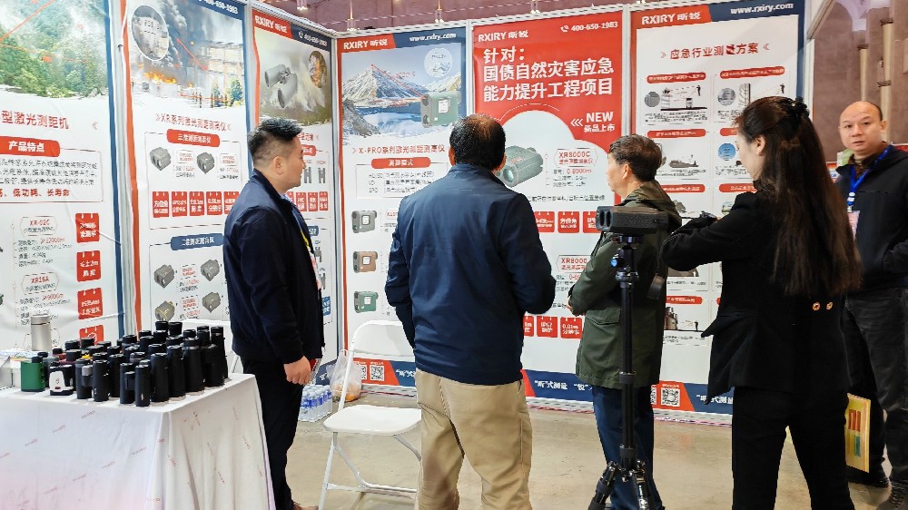
2025年5月28-30日,昕锐RXIRY受邀参加2025中国(杭州)国际消防安全及应急救援展览会,展位号H153,展会正在进行中,欢迎大家前往展台参观。 展位上有多种望远镜和测距仪供您试用,增添望远镜和测距仪在应急救援工作中的具体使用知识,更有1万米的测距仪在展台等您体验、开拓眼界。展会概况——C...
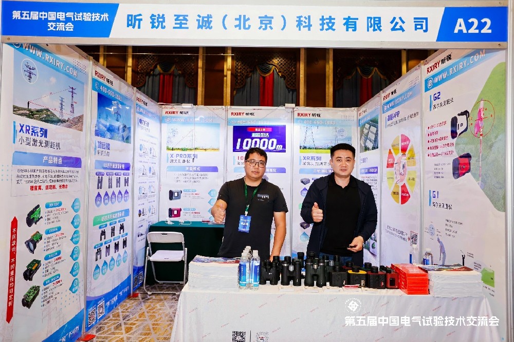
江城五月天,共绘检测新图景!2025年5月15-16日,RXIRY昕锐携所产激光测距仪、望远镜等测量仪器前来武汉参加第五届电气试验技术交流大会,诚邀您亲临现场,触摸前沿科技,体验精准测量的革新力量,用精密刻度解构江湖诗意,以远方视角重识大城气象。当测距仪遇见长江大桥以毫米级精度,丈量1600米钢铁长龙的世纪心跳...

RXIRY昕锐硬核科技亮相重庆消防应急展...
测距仪 测线 测高仪...

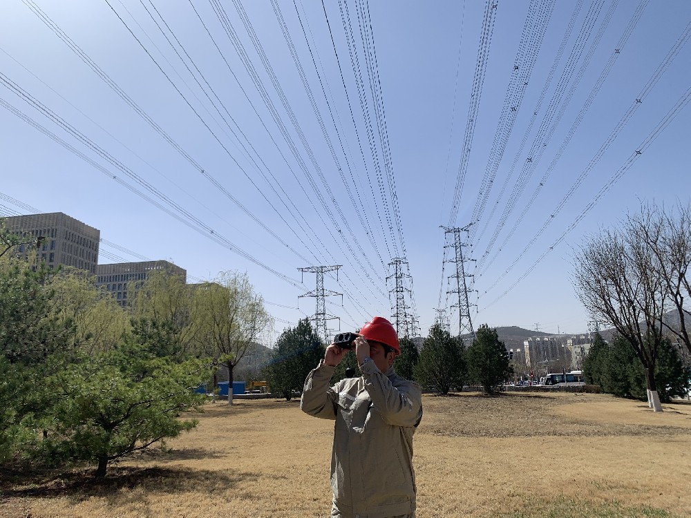
昕锐激光测距仪,以SD/HD/VD三维联测技术为核心,精准解决电力巡检、危化应急等高危场景安全监测难题。8000米量程+厘米级分辨率,一键联动三维数据,赋能行业安全决策。国产创导品牌,服务电力、安监等20+领域。...

户外测距难?距离太远看不清?精度不够总翻车?遇到不良天气直接罢工?……无论是电力巡检、工程测绘,林业巡查还是户外探险、市政测量,一台性能强悍的、功能齐全的、一步到位的激光测距仪都尤为重要!但是市面上的测距仪琳琅满目,如何挑选呢?...
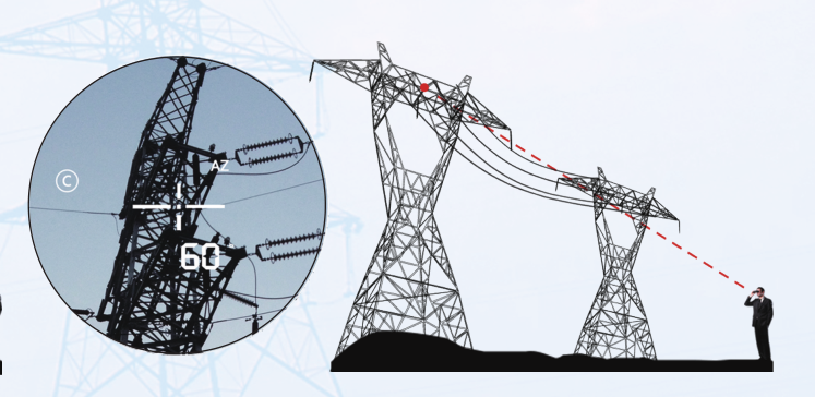
方位角方位角,又称地平经度(Azimuth angle,缩写为Az),是在平面上度量物体之间的角度差的方法之一。是指从某点的指北方向线起,依顺时针方向到目标方向线之间的水平夹角。用“度”和“密位”表示,常用于判定方位、指示目标和保持行进方向。由于每点都有真北、磁北和坐标纵线北三种不...
望远镜是一种利用透镜或反射镜以及其他光学器件观测遥远物体的光学仪器。其利用通过透镜的光线折射或光线被凹镜反射使之进入小孔并会聚成像,再经过一个放大目镜而被看到,又称“千里镜”。望远镜大致可分为单筒望远镜和双筒望远镜两种。单筒望远镜多为20~60倍,适合观赏远距离且移动相对较慢的物体,且需配合三脚架使用。双...


 顶部
顶部